


Trekking of Mt Buko is popular trekking near Tokyo. Mt Buko is one of 200 best Japanese mountains located in Chichibu, Saitama Prefecture. The altitude of Mt Buko is 1,304m from the sea level. The trekking takes 6 hr. and 30min. The altitude difference is over 1,000m. So, it is a very hard trekking.
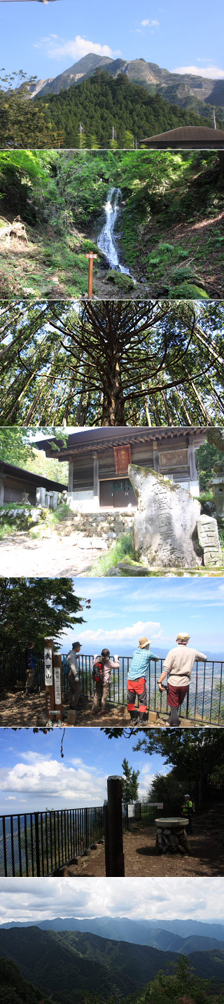
On the top of Mt Buko, it has a great view of Chichibu and there is Ontake Shrine.
The most popular course is starting at Yokoze Station and climbing up the top and finishing at Urayamaguchi Station. From the Yokoze Station to the entrance of the mountain, we recommend to use Taxi, apx. 2,000 yen.
The Course
1. 1st Torii Gate.
2. 18th station water point and Fudo Waterfalls.
3. 32nd station Great Cedar.
4. Ontake Shrine and the summit of Mt Ontake.
5. Crossing point.
6. Chojayashiki no Atama and water point.
7. Wooden Bridge.
8. Great Cave.
The course map http://www.hikingmap.jp/hikingmap/pdf/course_buk.pdf