Language /zhtw/zh

The Summit of Mt.Fuji

Get the Flash Player to see this video.

Share

Information

Area: Southern Fuji
Category: Nature Parks > Mountains

The Summit of Mt.Fuji (富士山頂) is the highest place in Japan. The altitude of the summit is 3776m from the sea level. It is called “Kengamine(剣ケ峰)” of Mt.Fuji. The flat land area which is surrounding the volcanic cone of Mt.Fuji is called 10th station which considered as the top of Mt.Fuji. The altitude of 10th station is 3720m from the sea level.

Tourist Info.
There is Sengenshrine at Fujinomiya Route, and Kusushi Shrine at Yoshida Route. A post box is placed at Fujinomiya Rout side. Walking around the volcanic cone takes 90 min.

Access to Southern Fuji Area

Southern Fuji (富士)
Terminal Station: JR Fuji St.
Access from Tokyo:
-By train
0.At Tokyo Station,
1.use Shinkansen to Shinfuji St. (1 hr. 12 min.)
2.use JR Tokaido Line to Fuji St. (2 hrs. 30 min.)
-By car
use Tomei Expressway to Fuji (2 hrs.)


Map around The Summit of Mt.Fuji

Nearest Videos


Fujinomiya side of Mt. Fuji


Fujinomiya Climbing Route


The Middle point of Mt Fuji


360 degrees view of Mt. Fuji


Fuji Homi Shrine


Juurigi Highland

Detailed Travel Guide for The Summit of Mt.Fuji

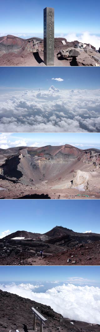
To the top of Kengamine, the summit, takes another 20 min. from 10th station of Fujinomiya Routes and 50 min. from Yoshida Route. From the Fujinomiya it required climbing up the hard slope, and there is no wind shield. If a wind is strong, never try to climb up this summit.

It has the great view of all west side of Mt. Fuji and you can see the bottom of the cone.
  Copyright © 2007-2010 all rights reserved.
Legends