MustLoveJapan

Mt. Myogi

Travel Information

Mt. Myogi (妙義山) is one of three major mountains in Gunma Prefecture. It is 1,162m high. Because of its unique shape of the mountain, it is chosen as one of three great unique view of Japan, and national view of Japan, and 100 best views of Japan. There are many hiking courses which you can enjoy interesting stones, such as rock gates, and at the observatory which located on the hard cliff side has great view of Gunma area.

Tourist Info.
There is a parking. There is two entrances for Mt. Myogi. West side is more popular because you can enjoy unique rocks and view easily.

Access
0. at Takasaki Station
1. use JR Shinetsu Line to Matuida (23 min.)
2. take taxi to Sakuranosato (30 min.)
3. walk west (10 min.)


Featured in

Samurai Movie The Ronins New Wave Samurai Movie.

MLJ Online Shop

the Ronins 映画好き集まれ!

Map around Mt. Myogi

Detailed Travel Guide

Mt. Myogi

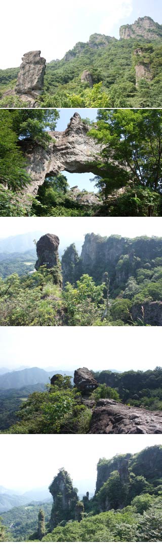
Mt. Myogi was formed by volcanic activities. The lava of the volcano was weathered for many years and became very unique shape. Mt. Myogi is consisted with Five mountains: Mt. Hakuun (1,104m), Mt. Kondo (1,104m), Mt.Kinkei (856m), Eboshi Rock (1,117m) and Mt. Sekyu(1,162m).

The entire mountains are Prefectural park of Gunma. Many people visit here for enjoying unique rocks and beautiful scenery, especially in Fall, it has Autumn leaves.

You can get a map at Michinoeki.