


The altitude: 1500m from the sea level.
The altitude difference: 10m.
For people: Beginners and kids friendly.
Time: 4 hours to 6 hours.
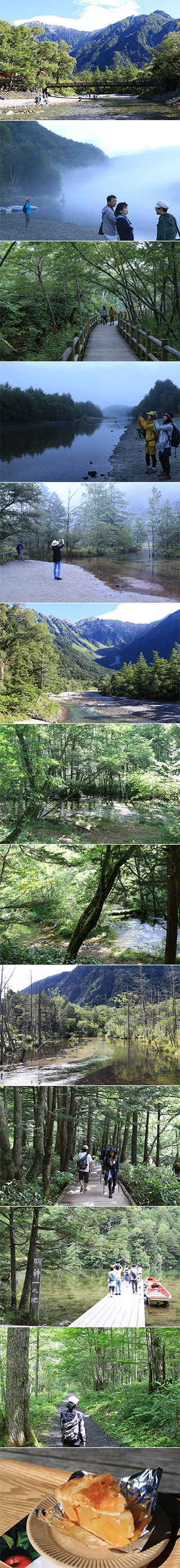
Kamikochi Highland is one of the most popular tourist spots and nature spots in Japan. It is located in Matsumoto, Nagano Prefecture. It is considered as one of the best scenic beauty spots in Japan and registered as Special National Scenic Beauty and Special Natural Monument of Japan. There are many hiking trails and very easy to walk because it is very flat trail. You can enjoy great forest, pure water and ponds and breathtaking views of surrounding Mountains. From Kappabashi Bridge, you can have a great view of Hodaka Mountains.
Kids friendly.
Hiking Route
Start at Taisho Pond bus stop.
20 min.
Tashiro Pond.
20 min.
Kappabashi Bridge.
70 min.
Myojin Pond.
60 min.
Tokusawa.
2 hrs.
Back to Kappbasashi Bridge and Bus Terminal
It will take 6 hours