MustLoveJapan

Hiking at Mt. Shiga

Travel Information

Hiking at Mt. Shiga (志賀山ハイキング) is one of the popular hiking spots you can enjoy at Shiga Highland, Nagano prefecture. It is about 6.2km long and takes about 3 hours for a round trip. This course travels Mt. Shiga and Mt. Urashiga. Mt. Shiga is 2,035m tall and Mt. Urashiga is 2,040m tall. Also, you can enjoy a great marsh called 48 ponds with many beautiful ponds and mountain flowers.

Tourist Info.
There are parking and restroom.
The lift fee: 700 yen for a round trip.
Time: 8:45 to 16:45

Access
0. at Nagano Station.
1. use a local bus to Shigakogen.
2. use a local bus to Szurigawa.


Samurai Movie The Ronins New Wave Samurai Movie.

MLJ Online Shop

the Ronins 映画好き集まれ!

Map around Hiking at Mt. Shiga

Detailed Travel Guide

Hiking at Mt. Shiga
Mt. Shiga: 2,035m
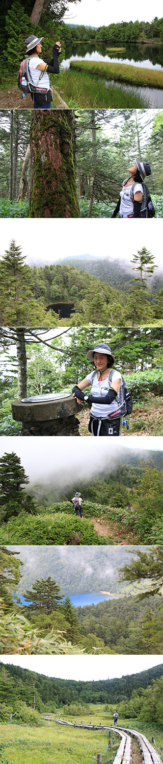
Mt. Urashigara: 2,040m
The distance of the trip: about 6.2km
The altitude difference: about 300m
Season: From June to the middle of October.

Start at
Maeyama Summer lift.
Shibuike Pond
Mt. Shiga
Mt. Urashiga
48 ponds
Maeyama Summer lift.